Day 275
April 12,
2016
NM Today: 15
NM Total:
4181
Note: Pictures have now been added to posting from 4/8 to 4/11
Note: Pictures have now been added to posting from 4/8 to 4/11
 |
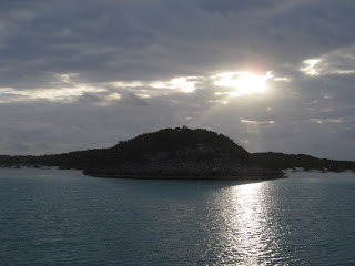
| Sunrise at Hawksbill Cay |
We listened at 9:00 a.m. for our mooring assignment at the
Exumas Land and Sea Park and then headed on our way to our next stop. As we left the surrounding area, we saw a
very large vessel at anchor here. With the size of the boat and the design, it
looked like some kind of military troop ship. With the AIS system that allows
us to see details of boats broadcasting information, Clark was able to pull up
a description of the boat.
She was a pleasure craft. Her name was SCAT (what an awful name for a luxurious vessel), with a length of
233 feet and a beam (width) of 33 feet. To put that into perspective she is
almost as wide as we are long. As with another vessel we saw recently, SCAT has a “garage” built in for her tender
(dinghy) boat. I began to think about what it might cost to maintain and
operate a vessel of that size and just calculating out the cost of one night’s
dockage plus some sundries put an end to that exercise. At $3.00 per foot of
vessel, for example, one overnight stay would cost about $700 then add the cost
of buying water in the Bahamas at say 50 cents per gallon and electric at some similar
charge per kilowatt. Of course there is the cost of a full crew to feed and pay
salaries. I found it mind-boggling to have that much money to afford a vessel
such as that one.
For miles as we continued on our way to Warderick Cay I
could look back and see SCAT. At one
point I noted that she looked about the same size as one of the islands off in
the distance.
Though a little choppy through Warderick Cut, the waters
were mostly calm for our two-hour journey to park headquarters. Warderick Cut and concern for rough waters
caused us to wait until today to make the journey to the park. It was worth the
wait!
 |
| Chart Picture for Warderick Cay (our mooring assignment puts us very close to the place marked as “dinghy landing”) |
 |
| Blue Waters of the Cays |
 |
| Warderick Cut |
We arrived at the park and had ourselves attached to our
mooring ball by 11:30. Since the park office closed at noon for a one-hour
break, we scurried around to get the dinghy launched so we could get over
there, checked in, and pick up some literature on the park to assist with
activity planning.
Park Headquarters has a dinghy dock that we tied to. The top
of the dock was way up over the dinghy. Steps on the side of the dock provided
access to boaters to climb out and tie up their boats. I found the height of
the first step from our dinghy daunting and wondered how I would manage to
climb out. Of course Clark zipped out of
the dinghy and up the steps like nothing. How irritating he is!
We landed on the left side of the dinghy dock where Clark
scrambled out. Then he moved the dinghy to the right side of the dinghy dock with
me sitting in it since he thought that would be a preferable side to dock on. I
should have climbed out before he started moving it because when we got to the
other side I saw that I had to step even higher to get out. Finally, after much
whining on my part, I managed to get out by stepping on the dinghy seat. That
made me so nervous it motivated me to expedite my departure from the dinghy
onto something more stable.
We checked in for two nights and purchased two days’ worth
of WiFi @ $15 per 100 MegBytes per 24 hour period. When we exited the park
office, we decided to look around a bit before heading back to Sea Moss for lunch. As we surveyed the
area holding our trail map in hand, a man from the park asked if we needed
assistance, so Clark talked to him at length about where to go and what to see
on land.
He gave us detailed instructions on how to find our way
along the trails. While he was at it, he mentioned that Poison Wood trees are
prevalent along parts of the trails. They are distinguishable by their orange
coloring under the bark. He told us that in some areas where the trail is steep
people tend to grab hold of trees to support themselves as they climb. It is a
very bad idea to clutch a poison wood tree!
 |
| Poison Wood Tree (note the orange-color under the bark) |
Before we left to go back to Sea Moss for lunch, Clark did a bit more scouting around and took
some pictures of the area.
 |
| Sea Moss swinging on her mooring ball near the floating dinghy dock. |
 |
| Un-intimidated Lizard Watching us near Park Office |
I made Clark drag the dinghy around to the lower side of the
dinghy dock so that I had a hope of climbing in. That worked fairly well as the
step on that side sat just that inch or two lower to allow me to step in
without fear. We went back to Sea Moss, had lunch, and prepared for our hike on
the island. I decided to wear my swimsuit which has become my clothing of
choice for the Bahamas as it prepares me for almost any activity we might
encounter.
Since the tide was still going down, the top of the dinghy
dock was even higher up than it was two hours earlier. Gulp! To add to the
anxiety of dealing with getting out of the dinghy, the park attendant was there
to tell us we had to pull the dinghy out of the way because a big boat was
coming in. Clark dragged the dinghy first one way then another to get it
situated in its final resting place while we explored the trails. Good Lord! We
arrived at mid-tide with the tide going down. What was I going to have to deal with when I
came back after our hike?!
Here is a picture of the “big boat” that came in – a Royal
Bahamian Park Defense ship. To protect the area as well as the park warden from
poachers, this defense team is permanently stationed at the park.
 |
| Royal Bahamian Park Defense Vessel |
The park attendant had told us to head to Boo Boo Hill and
then make our way around the trails to come back to the park headquarters. Boo
Boo Hill is named for the sounds of the ghosts that haunt this area. Many years
ago a schooner sank off Warderick Wells supposedly carrying missionaries. They
all perished and not one body was recovered. Local people say that at the full
moon, the lost souls can be heard singing hymns and talking and calling to each
other.
Shortly after we started up Boo Boo Hill trail we came to
Banshee Creek. The park attendant had told us that at low tide this area has no
water, and at high tide the water comes up to about knee high. We arrived
somewhere in between those two extremes.
We took our shoes off and waded across barefoot.
 |
| Banshee Creek |
When we got to the far side of Banshee Creek, we stopped to
dry our feet and put our shoes back on. Some folks speaking in a foreign
language came by and trudged right through the creek with their shoes on. I
knew we planned on hiking and I did not want to get blisters from hiking with
wet feet.
Shortly after we left Banshee Creek, we saw dark clouds
coming in and the wind picked up. Then the rains came down. I could hear the
rain as it made its way towards us. Finally it hit us full force. How the
foreigners must have laughed at our efforts to keep our feet dry when the rest
of us got drenched.
We tried hiding under a few scrawny palm leaves a couple of
times, and at one point Clark picked up a palm leaf and put it over his head
and called it his umbrella. It did not keep him dry so it got tossed pretty
fast. We walked on as it seemed the rain would most likely pass quickly.
We climbed up Boo Boo Hill and saw what appeared to be a
pile of trash.
 |
| Pile of Trash on Boo Boo Hill?? |
On closer examination we found the pile of trash to be a
very large pile of driftwood – each piece with the name of a boat bringing
visitors to Boo Boo Hill, the date they visited, and their home port. A sign
nearby said “Take Only Pictures”. I
certainly did not want to take any of the signs!
We took some pictures of the area and then headed back down
the hill to go see the Blow Holes. Since
the tide was not at high tide or close enough to it, we did not get to see any
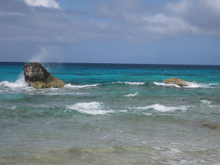
blow holes in action. We could hear the waves hitting deep down inside however,
and they sounded just like a whale getting ready to blow. In fact I jumped back
out of the way the first time in fear that the waves would make it through.
Just about that time, as expected, the rain moved on and the
sun came out in full force. The rain had felt cold and I had started to feel
chilly. I knew with the sun out that it would not take long to warm up. In fact
it did not take long for it to feel great that I had on wet clothes to keep me
cool as I hiked the hot trail.
 |
| Waves Crashing near Blow Hole Area |
 |
| View to Southeast from Trail |
 |
| Trail |
 |
| View of Emerald Rock Cay |
 |
| Boo Boo Beach |
 |
| Lion-Shaped Rock in Water |
 |
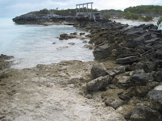
| Rocky Terrain Near Boo Boo Beach |
 |
| Typical Trail Marker Decorated with Locally Collected Shells |
The trail, depending on which part we happened to be
walking, consisted mostly of sand and rock. The sand filled my shoes such that
I had to stop multiple times to empty the contents in order to continue. The
rock was sharp and holy. When least
expected we would find a rock that appeared to be solid but was in fact quite
wobbly when we stepped on it.
 |
| Sample of Trail |
 |
| Sample Section of Trail |
 |
| Yet another sample of the terrain on the trail (here we had trouble deciding where to find the trail) |
 |
| And yet another sample of the terrain on the trail |
As we walked along we came to a giant hole in the ground
with a makeshift ladder coming out of it. The sign tacked up on a tree there
said “Murphy’s Hideaway”. It looked entirely unsafe to me as I peeked over the
ledge into the abyss below. I looked at Clark and found he was handing me his
backpack so he could climb down. “Oh
Clark, God NO!” I exclaimed. “I can’t go”, he pouted. “No”, I said, “Who knows
how old those rusty nails are that are holding the ‘rungs’ of that ladder!”
Surprisingly he gave up without a fight.
 |
| Murphy’s Hideaway (hole in the ground) |
 |
| Ladder into Murphy's Hideaway |
 |
| View from the Top of Murphy’s Hideaway |
As we walked away from Murphy’s Hideaway I felt guilty for
stopping a little boy from having his treat. I also thought about the fact that
if he fell into that hole because the ladder gave way, I had absolutely no way
I could ever get him out of there. The guilt did not last too long.
We were glad the park attendant had given us careful
directions. Although piles of rocks, some signs, and yellow paint splashed on
the rocks marked the trail, in places the trail appeared to disappear without a
trace. With some scouting on occasion we made our way. Sometimes, when we were
high enough, we could see the path we would eventually take.
As we approached the wooden bridge we had seen from up the
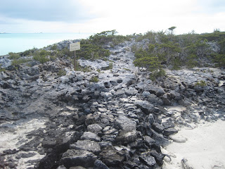
hill, I could not believe how rough and narrow the path to the bridge looked.
 |
| Path to Bridge |
 |
| Another View of Path to the Bridge (with wobbly rocks) |
Clark led the way and as he traversed the walkway to the
bridge, he exclaimed, “Some of the stones are loose!” When he arrived at the
bridge, he called back, “Some of the wood on the bridge is loose too.” Grateful
for the advance warning but far from pleased to hear these announcements, I
carefully made my way along both the rock path and the wooden bridge to the
other side.
I breathed a sigh of relief when I finally stepped off the
bridge. A sign greeted me there saying “Sunshine Causeway”. I am not sure what
a “causeway” is, but I thought perhaps the area was misnamed.
 |
| Sunshine Causeway |
Shortly after we found ourselves on Sunshine Causeway, a
group of four people (2 men / 2 women) appeared coming from the opposite
direction. They inquired as to where we had come from and how long it took us.
Clark explained that we had come from Boo Boo Hill and gave details on the path
we took to get to this point. When they asked, “What did it take? 10? 15
minutes?” Clark said, “Yes, about 15 I would say.”
As we walked away, I looked at my watch. “Clark, why did you
tell them it would take 15 minutes to walk a distance that took us over an
hour?” I inquired. “Oh, did it take that long? Well, we stopped and took
pictures and such.” One of the two men
in that group was extremely unwilling to walk even another five minutes. I
wondered how far they went, how long it took them, and if they ever got to Boo
Boo Hill.
Further along, just as we approached the end of our hike, we
passed two Canadian men coming from the opposite direction who asked us about
our travels. Clark started to explain
how to go to get to Boo Boo Hill and told them it had taken us an hour. “Sounds
too much like hard work”, one of them exclaimed. They were looking for a much
shorter hike. We told them to cross the beach and take the short path directly
to Boo Boo Hill instead of going all around the island to get there. That made
them happy as we parted ways.
The hike completed we arrived back at the dinghy and as
predicted the drop from the top of the dinghy dock down to our dinghy was
significant. As Clark looked over the ledge at the dinghy far below, he asked
me if I could make it down there. Well if I wanted to see Sea Moss tonight, I did not really have a choice now did I!?
Upon arrival I had surveyed the setup and confirmed my
suspicion that although not a step per se, there was a board nailed across the bottom
of the dock as part of the infrastructure. When I reached the last step, I went
backwards off the dock and found that board with one foot so I could easily
step into the dinghy. Yay!!!
Even after the long, hot hike my “energizer bunny” of a
husband had more exploring he wanted to do -- this time in the dinghy. We took a little trip around the side of the
park headquarters building to see the house on the other side. I could not
believe my eyes when I saw a sailboat at dock there that hailed from
Wallingford, Connecticut where my son and his family live!
Given we had internet for the first time in a number of
days, I got busy posting blog entries and Clark got busy reading mail and such.
By 9:30 I found myself bleary-eyed and ready for bed. He had hovered over my
shoulder for the last entry. I find my creativity stifled when under
observation. I told Clark I just couldn’t write anymore and we called it quits
for the day.


No comments:
Post a Comment