27 March 2024
Road Trip in Long Island
Today we drove the length of the Bahama’s Long Island, which
is approximately 80 miles long. Our travels took us across the “Tropic of
Cancer” as shown on the map below.
Approximately 4000 people live on the island. We saw very
few of them. Even the schools appeared to be closed. Perhaps because it is
Easter time the children were off from school. Some businesses were closed for
the next two weeks. We did get to see some interesting and unusual sights as
well as beautiful scenery.
The car rental place opened at 8:00, so we got ourselves in
the dinghy and over there shortly after they opened. They had a Toyota ready
for us. Clark noticed that there was a big sign on the window “Keep Left” as we
got in to start today’s exploration. Several times today I tried to get into the "passenger-side" door only to find a steering wheel there!
Our first stop after getting the car was to the Bureau of
Tourism to get some information on where to go and what to see. We had a twenty
minute wait when we got there, however, as they did not open until 9:00. We got
underway from there about 9:30 with some travel literature in hand.
Having anchored off Salt Pond in the middle of Long Island,
we could go north or south to start our drive. We basically tossed a coin and
decided to head south first.
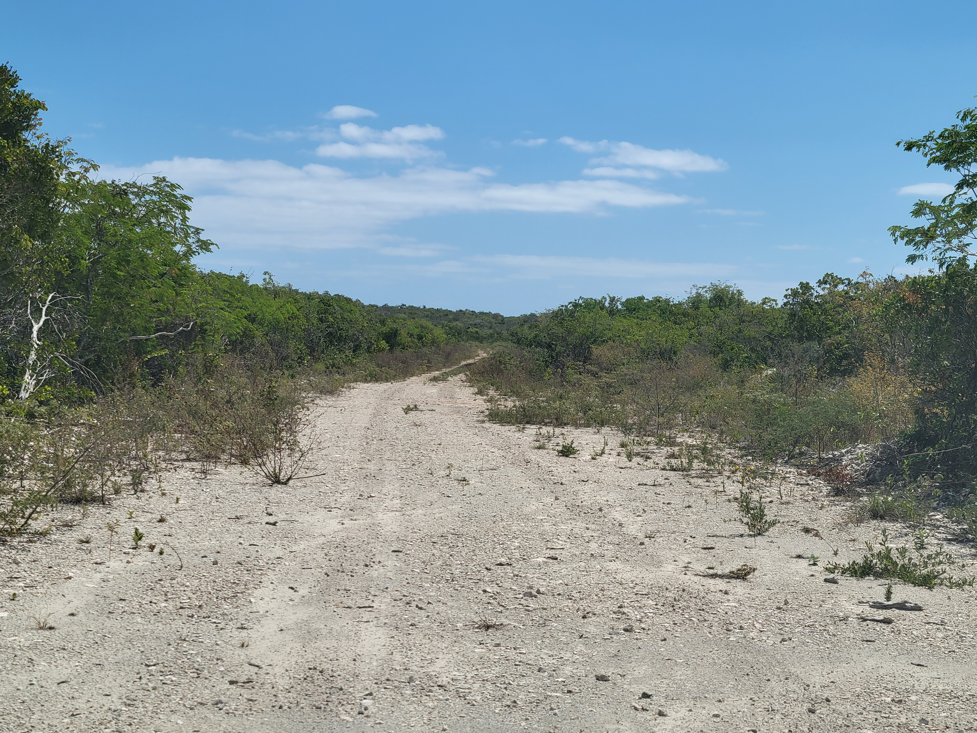
We saw miles of this …
And lots of homes in less than stellar condition.
We passed many village signs where some appeared to have
nothing to offer – not even houses. Others had convenience stores, bars and
places offering food, and other miscellaneous shops. The one thing we saw over
and over again was churches in all sorts of denominations. We wondered how so
many churches could be sustainable on such a scarcely populated island.
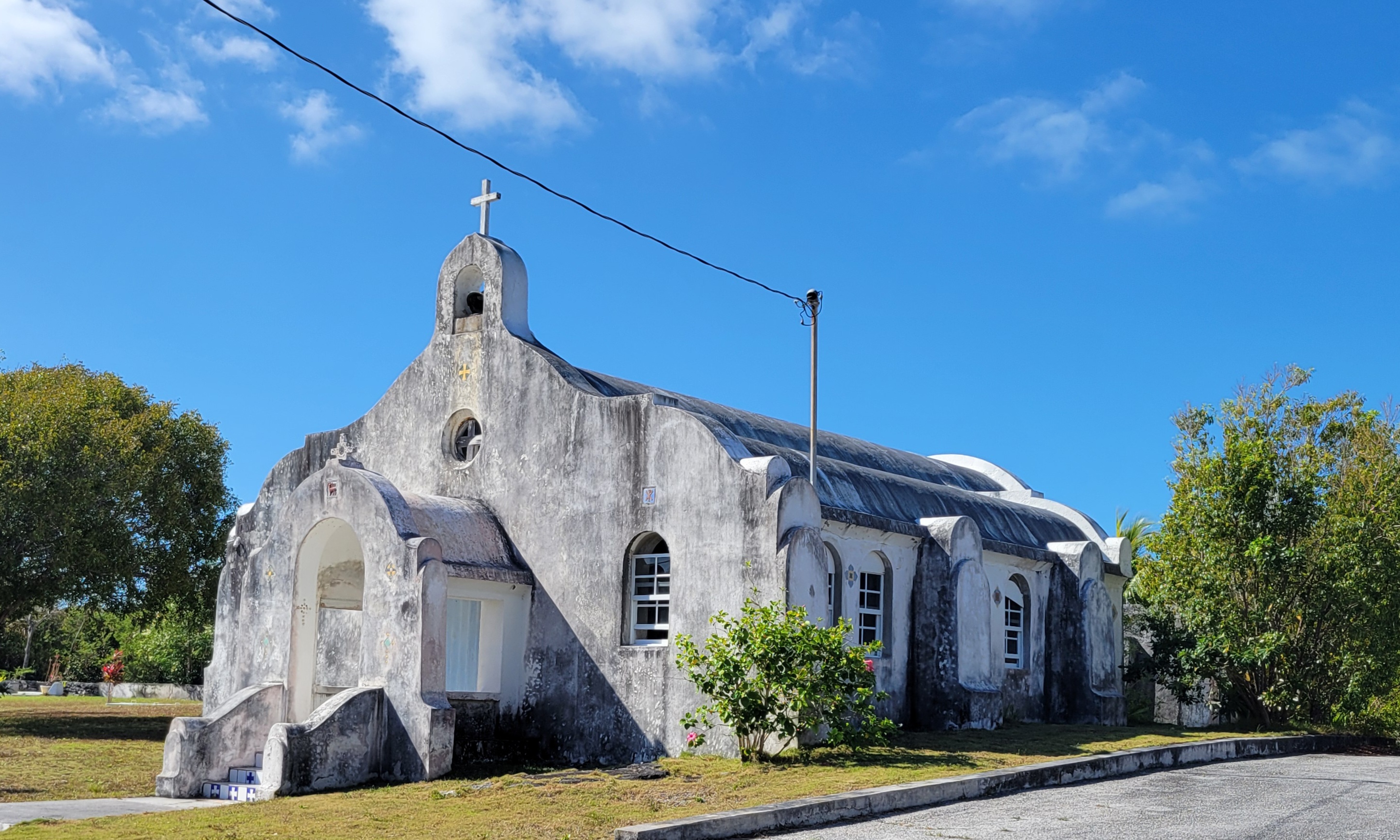
One of the churches we saw, “Our Lady of St. Carmel”, had
two buildings – the 1938 church, which looked way older than the date would
suggest.
And the modern version
 |
Our Lady of St. Carmel
Roman Catholic Church |
In Clarence Town, which is the capital of Long Island, we
found the twin churches designed by Monsignor Jerome Hawes. These are St. Peter’s
Catholic Church and St. Paul’s Anglican Church.
 |
| Cistern and Water Pump at church |
We thought we were on a road that would take us to Cape Verde,
which is planned to receive cruise ships sometime in the future. What we found
instead was the end of the road at Gordon’s Beach!
The restaurant at Gordon’s Beach had a separate building for restrooms, so we decided to take advantage before getting back in the car. In the lady’s room toilet, I flushed it before using it because it looked like someone had left something nasty in there. However, as the water started to go down, the turd started to kick and swim. It turned out the turd was a toad! What a shock that was!
I had no means to get the toad out of the toilet, and I had no desire to plant myself over him to use the toilet – unpleasant for both me and him should I do that. I zipped up my pants, came out and told Clark I was going in the men’s room and he should watch the door for me! I left the seat up for the toad in case he could figure out how to get out on his own without that in his way.
 |
| Restrooms on right |
After that, we asked at the restaurant for directions to Cape Verde and were told we could follow the dirt road until it ended and then walk the rest of the way. Thus far, there is no connection for cars to travel between the two locations. We started down the dirt road, which quickly deteriorated, until we decided it was pointless to go any further.
We retraced our path and started heading north.
On our way into Gordon’s Beach we had seen a rooster, goats and even pigs crossing the road. Coming back the other way we found many goats walking up the middle of the road. The baby goats were so darn cute! The goats were smart enough to get out of the road for the car.
I had told Clark to look out for a signpost that I wanted to
take a picture of. In Dunmore, we found more than just a signpost! We found evidence of pirates!
Occasionally, we got good views of the ocean. It was quite
impressive today as the waves crashed into the shore.
As we approached Clarence town, I happened to spy the Flamingos at Chancery Pond. We were told that one had a broken wing, so they live here year-round. We had heard about them from other boaters but did not know where on the island we would find them. It was quite by accident that I noticed them out the car window as we drove by. Clark quick pulled over and took some pictures.
 |
| Coming into Clarence Town |
We decided to eat in Clarence Town and found “Rowdy Boy’s Bar and Grill” as we wove our way through town.
 |
| Rowdy Boy's Bar and Grill |
The grounds had pretty flowers and a lovely trellis walkway.
The view out the back of the restaurant was breathtaking.
When we stopped at Gordon’s Beach to get some local knowledge at the restaurant, Clark got details on how to get to Dean’s Blue Hole. We saw a sign for it on the way south, but the road had a sign on it saying it was a Private Road that did not look inviting. It turned out that was the correct road to get to the Blue Hole.
As we bounced along the dirt path, it felt like we were off-roading it.
On this long dirt road, we suddenly found a nicely paved section with a house located there.
 |
| Nice view from here |
Continuing on, we found the sign that said we were on the right track.
The warning sign at the entrance was folded over on itself and curled at the edges. Clark unwrapped it to see what it said. The water suddenly plunges to 663 feet deep!
We walked down to the beach to see the Blue Hole, and suddenly I noticed Clark was missing. I decided to look up to see if I could find him.
 |
| Yep! There he is way up high. |
 |
Me taking a picture of Clark taking a picture.
|
He said the views up there were great.
 |
Once you see it, you understand why it is called
the Blue Hole |
The area had lots of great rock formations and cave openings.
We had been told we should bring our swimsuits. We did not. Clark regretted it after seeing the gorgeous water.
After leaving Dean’s Blue Hole, we debated whether we would have enough time to see the northern half of the island as it was already 2:30. We thought perhaps we would have to rent a car for a second day but decided to see how far we could get today.
We stopped in Deadman's Cay at a restaurant with a sign that read - "Ice cream brings joy!" Alas, the place was closed for Easter break, so as Clark said, "We found no joy here!" From there we traveled back through Salt Pond and saw the now familiar sights there. Then onward to the north.
On the road south, we had seen some potholes. On the road north, the road was covered in them. Clark, as well as the other cars on the road, swerved all over the road trying to dodge the holes. As we hit almost as many as we missed, I wondered if the tires would survive. They really should rent vehicles designed for off-roading!
Although there are many towns listed north of Salt Pond, there was little of interest to us. For example, we passed by the resort at Stella Maris. We kept going until we reached the northern-most end of the island where we found the monument dedicated to The Lucayans aboriginal people of Long Island and Christopher Columbus, who supposedly stopped here in 1492 on his way to discovering America.
 |
| First view of monument (on left) |
 |
| Walking from parking lot |
 |
| Whoops! Forgot my hat! |
 |
| Got it! |
Views from the monument were amazing.
 |
| Turbulent waters |
It was a lot easier going down than it was climbing up.
Having hit the end of the road, we started on our way back to Salt Pond to return the car.
We had seen a sign for ice cream on our way to the monument and decided to try to find it on our way back. We did not find the one we had spied earlier, but we did find a sign at Glinton's Big Yard Gas station saying they had an ice cream parlor. Ordering ice cream, while standing next to containers of motor oil and carburetor cleaner, felt comparable to doing the same at an Auto Zone.
Bizarre to say the least! Still, it was fresh and refreshing, and we understand that life in the Bahamas is definitely different than what we are used to.
After our treat, we continued on our way back to Salt Pond to return the car. In Deals, we passed a section of road with a parklike setting and beach access. Clark stopped to take a couple of pictures here.
Further on, we took pictures showing where the hills had been carved our to allow for the road.
Our constraints on returning the car revolved around the time the gas station closed, i.e. 7:00. We pulled in there to fill up a little after 6:00. We had seen all we wanted to see plus more and still had an hour to spare – no need for a second day of car rental.
As we pulled into the station, I said, “Hey look! It’s an Esso!” We haven’t had Esso in the states for years!
Clark asked if I wanted to eat dinner out tonight since we were not onboard to pull anything out of the freezer to thaw. I told him I was “done in”, and I’d feed him something even if it was PB&J sandwiches.
We were back on board with the anchor light on for sunset. I fed him a chicken casserole for dinner.