30 April 2021
Depart: Enterprise Oxbow anchorage - Waccamaw River, SC 8:50
Arrive: Southport, NC - Cape Fear River anchorage 6:20
Distance: 60.5 nm
Conditions: sunny day, cool breeze
We pulled up the anchor just before 9:00 which seems to be our normal departure time.
 |
| Clark bringing up the anchor at Enterprise Oxbow |
We continued on our way on the tree-lined Waccamaw River.
 |
| Entrance to Osprey Marina on the Waccamaw River |
We needed two bridges opened today. The Socastee Bridge has a closed height of 11 feet, so only the smallest of boats can squeeze under. As soon as we called, the bridge tender said she would open the bridge for us with no waiting.
The second bridge we needed to open was the Little River Swing Bridge. Because several boats ahead of us had requested an opening and we had a way to go to get to the bridge, we worried that the bridge would open and close before we got there. That could mean a lengthy wait for the bridge to open again.
When Clark called the bridge tender to alert her of our presence, she told him to keep coming. Since we traveled against current in a slow speed / no wake zone, we were surprised she agreed to hold the bridge open. As it turned out, we got through and she continued to hold it open for another boat some distance behind us. Apparently, she was in no rush to close the bridge.
Little River Swing Bridge ...
The current was against us for most of today's travel. We had plenty of time to admire the scenery as we slogged our way along the ICW.
Erosion on the Waccamaw River?
Golfing along the Waccamaw River ...
 |
| Myrtlewood Golf Course |
The Myrtle Beach / Seaboard Coast Line RR bridge is normally open. We passed under without needing to wait.
 |
Looking up at the open RR bridge as
we passed through. |
At this point, the landscape had changed. No longer did we see nothing but trees along the side of the waterway. Now we saw many houses of varying sizes. What is amazing to see is how close some houses are to others. In some areas there is almost no space between them.
 |
| Nice Landscaping |
 |
| Huge houses |
Many homes were under repair or under construction.
 |
| New construction |
 |
Gray area is a foundation for a new house.
It's a wonder they can squeeze something that
size on the lot. |
After all the nice homes, we came to some commercial properties.
 |
Calabash Seafood Restaurant
and buoy graveyard |
 |
| Barefoot Queen Paddleboat |
Next, we entered the "Rock Pile". This is a narrow and deep channel cut through rock. At low tide the rocks are visible. We passed through nearer to high tide. Clark gave a security call on the VHF radio to let opposing traffic, if any, know that we were coming through.
 |
| "Danger Rocks" |
 |
The "Rock Pile" looks innocent enough!
No homes on the water here. |
 |
Example of what happens on Rock Pile
if not paying attention |
After exiting the Rock Pile, we came to the Myrtle Beach Yacht Club where we planned to pick up fuel. Clark called yesterday and found they had a favorable price per gallon, so we decided to stop here. Unfortunately, when we arrived another boat was tied to the fuel dock, and we had to wait our turn.
 |
| Lighthouse at entrance to Myrtle Beach Yacht Club |
Following 30 minutes of station keeping, we finally were called in to pull up to the dock. As we waited we watched the boating traffic go by.
 |
| "Miss Shelby" Dredging Barge |
 |
| Tiny Tiki Boat |
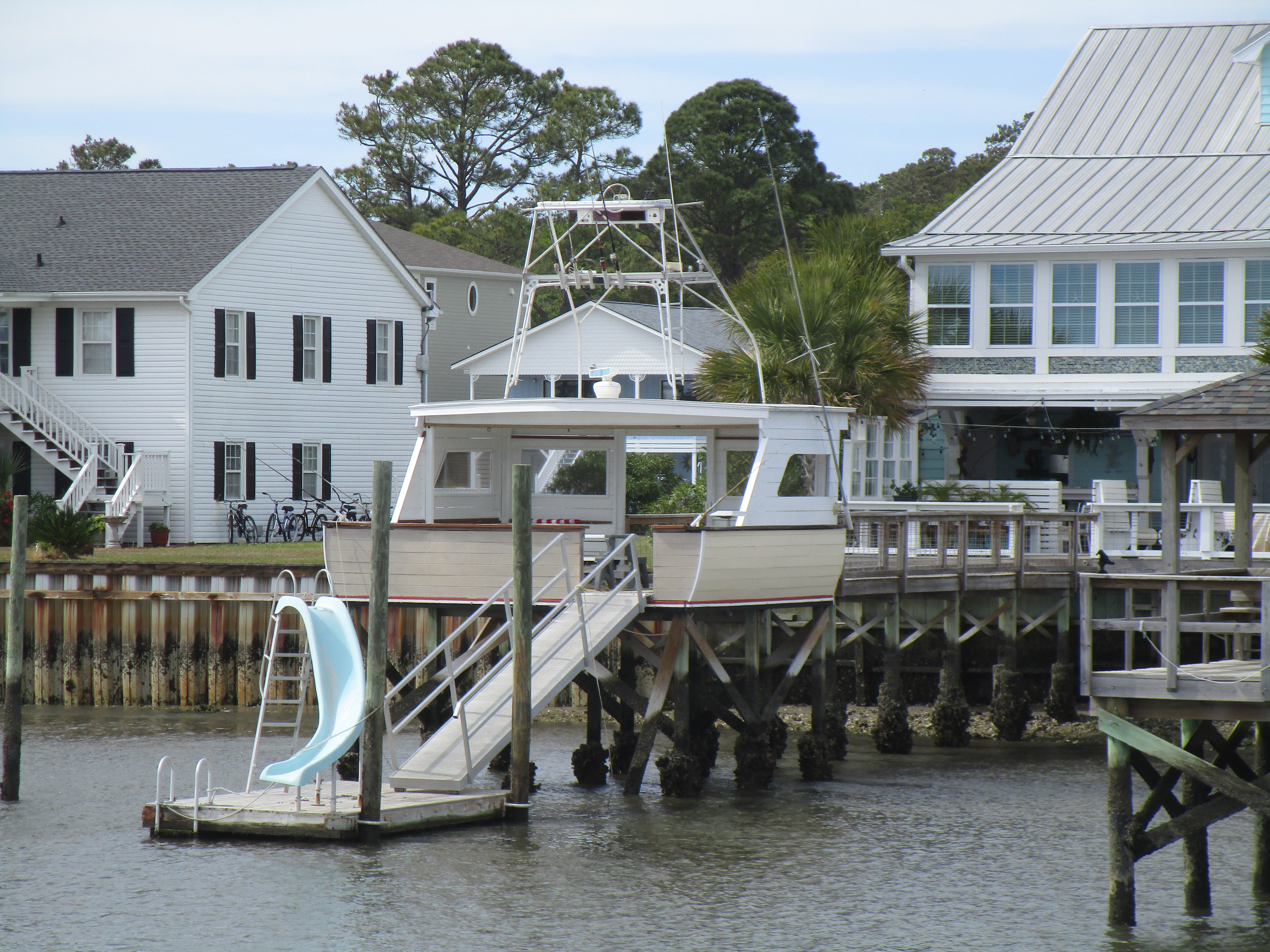
Clark spotted a dock with an unusual design.
 |
| Novel Dock Design - looks like the back of a boat |
By the time we finished fueling, we had lost 90 minutes of travel time. We had to rethink our anchorage plans for the night. If we continued on to our originally-planned anchorage, we would be arriving there at 7:30 or 8:00 at night. Clark said he would see what current we had on the Cape Fear River to make the final determination of where we would spend the night.
Shortly after we left the fuel dock, we also left South Carolina and entered North Carolina. We next passed through Southport where we got to see the progress the marina has made making repairs since suffering serious hurricane damage.
 |
Southport Marina - docks are coming back
|
 |
Sign in front says
"Now Open for Fuel" |
On the Cape Fear River, we had current against us and that made the decision on tonight's stop. The name of the river does not sound too inviting, but we have stayed here overnight before, and conditions seemed favorable for a good night tonight.
As we approached, we found a sailboat anchored here ahead of us.
 |
| Range markers near where we anchored |
 |
| Dock across river from where we anchored |
 |
Passing tug and barge
(I like blue tugs!) |
 |
| Sailboat sharing the anchorage with us |
We had a cloudy night tonight for sunset.
 |
| Sunset - Cape Fear River |