4 April 2024
With all the activities we have been doing, we used today as a day of relaxation. We were waiting for the winds to shift direction, and when that happened, we snapped some sky pictures as the front came through.


The cloud cover was still impressive later as we watched the sun set.

5 April 2024 Eleuthera, Bahamas
Depart: Rock Sound anchorage 8:10
Arrive: Spanish Wells south / Russel Island anchorage 5:20
Distance: ~ 63 nm
Conditions: Rainy start to the day; otherwise clear
We delayed this morning's departure slightly as we waited for a rain storm to pass before bringing up the anchor.
 |
| Sun's rays working their way through the clouds |
As our anchor came up, we watched first "Bagus" and then "Long Point" leave the anchorage before us. Our boat cruising a tad faster, so we passed them both shortly after departure.
 |
| First we passed M/V "Long Point" Kady Krogen |
 |
| and then we passed M/V "Bagus" Kady Krogen |
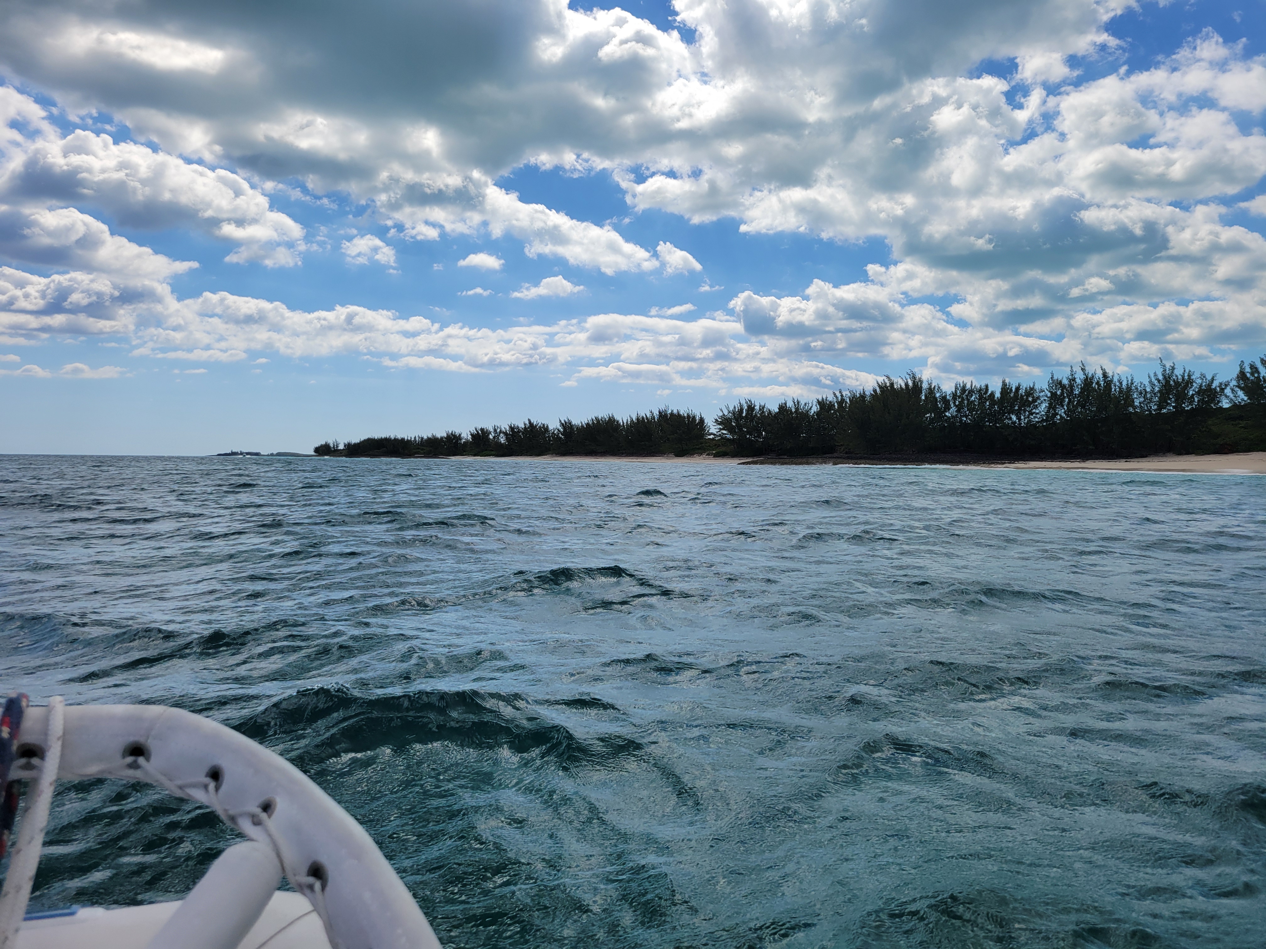
We traveled on open water for several hours, and at 2:30 finally reached Current Cut. Clark had tried to time our departure to get us here when the current would be near slack. It did not quite work out as he calculated. We had 3 knots of current against us as we passed through here, so instead of moving at 8 knots plus, we were running at about 5 knots (not quite 6 mph).
 |
| Shallow area near Current Cut the color of the water tells the story here, i.e. shallow by the beach. |
Approaching Current Cut ...


The water was moving fast, but not as fast as it could have been.


As we approached Current Cut, we heard the sailboat "Flo" make a security call as the space through here is tight. Being a sailboat, I expect they slowed down to next to nothing coming through the cut.
One of Clark's goals for today was to take on fuel at a place we stopped at back in 2016 when we visited here in "Sea Moss". Clark called the fuel dock as we approached, and the attendant dragged the very heavy hose down the dock to give us fuel. We took on 266 gallons and will not need fuel again until we are back in the States.
At first the attendant fed us fuel via gravity only. The flow was very slow. Clark said we could take it if he turned up the pressure, so he did. After that, we got a surprise as a lot of air came out of the hose whenever Clark pulled the trigger. It looked like smoke coming out of the fuel fill, so Clark was concerned. The attendant took the nozzle and put some fuel into a container until the fuel flowed smoothly then gave it back to Clark to continue pumping. There's always something new to encounter!
It took about 30 minutes or so to take on fuel, then at 4:30, we went in search of our place to drop anchor for the night. Clark chose the anchorage near Russell Island as that positioned him well for the activity he planned for tomorrow - to navigate the "Devil's Backbone"!
6 April 2024
Depart: Russel Island anchorage 3:15
Arrive: Royal island anchorage 4:15
Distance: ~ 5 nm
We packed up what we thought we might need for today's outing including a picnic lunch, loaded up the dinghy, and pushed off from "Sunset Delight" just before 9:30 this morning. Our expedition to navigate the "Devil's Backbone" took us past Spanish Wells to Harbour Island. Note: We visited Spanish Wells in 2016 and even rented a golf cart to take a well-liked tour of the island.
Picture's of the anchorage as we prepared to leave on our dinghy trip ...


Sights seen as we passed by Spanish Wells ...
As we approached the town, whom did we see directly in front of us but "Long Point". We followed them in. They turned left, and we turned right. Mary Ann signed me that they were going to the marina for a 10:00 arrival. We did not see them again after that.

We saw a couple of interesting boats as we passed by town.
 |
| Trawler: "Bottom Dollar" |
 |
| "Face2face Adventures" with shark cage |
 |
| The dinghy dock looked a little rough and tricky to get off the dinghy. |
 |
| Sign says "Welcome to Spanish Wells" |
 |
| View of Spanish Wells, Bahamas |
 |
| Looking back at Spanish Wells as we continue on to the Devil's Backbone |
By 10:15 we were approaching the Devil's Backbone! According to the website, this waterway extends across the northern end of Eleuthera about 1.4 miles northeast of Spanish Wells. The area is shallow with a "jagged-edged" reef. Over the centuries many boats have wrecked here. A list of some of them is shown on the tourism web page. It's supposed to be a great place to dive / snorkel.
As Clark navigated the Devil's Backbone in the dinghy, I took pictures. Periodically, he would shout out to me the name of the place we were passing. I took notes on my phone as best I could.
The first name he gave me was "Salt Kettle Bay".


 |
| This section was posted "Private Beach" "No Trespassing" |
 |
| It was a bit choppy in the dinghy, but Clark said we were lucky to get such good conditions for our ride. |
The next section he called out was the Iron Shore / Tay Day Beach. This beach is near Preacher's Cave, where according to the web site, the first settlers took shelter after their ship wrecked on the reef.


 |
| The darker colors indicate reefs |
 |
| Tay Day Beach near Preacher's Cave |
We have seen a couple of caves on this trip to the Bahamas, so we decided not to beach the dinghy to visit this one.
Several boats passed us at high speed through here. We saw a couple that looked like tour boats with lots of folks sitting in the bow and stern as they sped past. I noticed that these boats all traveled close to shore where the water appeared clear of reefs. Clark stayed more offshore over darker waters.
 |
| One of the boats that "flew by us" was a Bahamas Ferry |
When we talked to the folks on "Rock N Roll", whom we met on this trip to the Bahamas, they said they took their big boat through here. Pat, from RNR, said they charge big money to take you through on their boats. Clark said he thought it would be a "bit spooky" with the beach so close on one side and reefs on the other.
Next, Clark pointed out Hawk Point up ahead.
 |
| Hawk Point |
Shortly after rounding the point, Harbour Island came into view.
 |
| Harbour Island |
 |
| The marina here was packed with mega yachts - all the same make - at least 6 of them. Their tenders were over 25 feet long! |
As we approached Harbour Island, Clark called a marina here and asked about a dinghy dock and got directions on where to go to tie up. The entry to the dinghy area appeared blocked by a rather large boat across the entrance. We managed to sneak behind it and make our way in to tie up.
The first thing I noticed was that the water was low, the dock was high, and there were no ladders! I decided I would have to step on a board sticking out from under the dock to climb ashore. As we surveyed the situation, a local came up to us and told us to be careful to tie up so that our dinghy did not get stuck under the dock as the tide rose. Clark decided to throw out a stern anchor to hold us off.
He pulled up to the dock for me to climb out. It looked nearly impossible for me to get out, but the man who had spoken to us came over and gave me a hand up. For an elderly gentleman, he had one heck of a grip and practically pulled me onto the dock! Thank you sir! I hoped the tide would be up higher when we returned to leave.
 |
| Low tide |
 |
| No ladder! |
Before climbing out and tying off, Clark handed up our bags including the picnic lunch. He had me hold the bow line while he set the stern anchor, then had me pull him in, so he could get off the dinghy. Then he pushed it out and tied it off. It was quite a procedure, but we are getting used to it by now.
With that behind us, we set off to explore the town with the main objective of seeing the Pink Sand on the far side of the island. We enjoyed the stroll through town and the sights we saw along the way.
 |
| I liked the sign "Dilly Dally Dat Way -->" |
 |
| The tide was definitely out. Ferry Dock |
 |
| We walked past the "Big House on the Prairie" |
 |
| Clark on road to the Pink Sand Beach |
 |
| Public Beach (thata way) |
 |
| Clark said, "The sign says it all!" Pink Sands, Harbour Island |
After weaving our way through town, down streets and up hills, we finally found the entrance to the beach.
 |
| Entrance to the beach |
 |
| Only slightly pink |

 |
| Clark was expecting "pinker sand"! |

After admiring the beach, we did not have swim attire or towels, we went to find a place to sit and eat our picnic lunch. We found a small bit of shade at the end of the trail to the beach.
 |
| Our view as we sat on a wall to eat our lunch in a tiny bit of shade |
This town has golf carts everywhere. Many are rentals, but not all of them. We saw a sign that forbid golf carts from going onto the beach at a penalty of a $500 fine. Otherwise, they appear to be allowed to go anywhere else they wish.
 |
| Golf carts parked near entrance to beach |
Clark felt sure we would be able to find ice cream in town, and sure enough he found a shop for us to get a cold treat.

 |
| Metal Sculpture of a Rooster |
 |
| We found "Dilly Dally" |
Note: I tend not to go shopping as I do not want to be tempted to buy things I don't need, and I don't want to feel obligated to buy something because I poked my head into a shop.
 |
| Loved this sign as it made me think of my book-loving grandchildren! |
 |
| Clark walking down the narrow street with no sidewalk |
 |
| Barely wide enough for two golf carts to pass. Cars take up the whole road. |
I noticed that almost all the golf carts I saw had the steering wheel on the left / port side of the vehicle. Cars are a mixed bag of right side and left side steering wheels.

As we walked past the beach, I thought to myself "uh oh"! I had hoped based on the man at the dinghy dock's warning about high tide that the tide would be coming up. It looked lower than before!
 |
| Boats are still beached and appear higher and dryer than before! |
When we got back to the dinghy, we found that the water was indeed lower than when we came in. Instead of worrying about it catching under the dock, we had to deal with it being sluggish as Clark pulled it through the sandy bottom. More boats were in the dinghy space, and with the low tide situation, Clark said we were lucky he managed to get the boat out of there. The big boat still blocked most of the entrance to the area and impeded his exit.
I noticed a couple of ladders attached to other sections of the dock, i.e. not the dinghy dock, and suggested to Clark that he bring the dinghy to one of the ladders for me to get in. That saved me having to jump off the dock into the dinghy, and it put less weight in the dinghy which was already dragging in sand.
It took a couple of passes for Clark to get the dinghy to a point where I could climb in. When he pulled up the first time, I squawked that there was no place for me to step to get in. The points of the anchor were threatening, as they sat pointing upwards on the seat, ready to skewer me if I slipped. With the bags on the floor in front of the seat, there was not even floor space for me to step onto. I saw it as hopeless, so he turned the dinghy around with some tricky maneuvering, and I was finally able to get in and shove us off.
The ride back to "Sunset Delight" through the Devil's Backbone was much the same as the ride to Harbour Island only bumpier with a lot more spray. Every time one of those bigger, faster boats went by and made a wake, Clark had to slow down to climb over the waves. A couple of times we went airborne, and I came down hard on the seat when we hit the water. I actually got a bit of a headache from being tossed about so much. I was glad when we had covered the last of it. The distance each way we traveled today on the dinghy ride was about 10 miles.
On the way to Harbour Island, I saw a rock formation that looked like a face. By the time I had my camera in hand, the picture had changed. On the way back home, I signaled Clark to slow down.
 |
| Rock formation at end looks like a face to me with a big nose sticking out. |
Clark showed me the track we made with our dinghy traveling through the Devil's Backbone.
 |
| Green dotted line is our track through the Devil's Backbone |
When we got back to Sunset Delight, around 2:45 or so, I was ready to kick back and relax for the rest of the day. Clark had other ideas! He said he wanted to move to a different anchorage to save time on the next day's travel. So, instead of resting, it was back to work prepping for bringing up the anchor and moving onwards.
We arrived in the Royal Island anchorage around 3:15. A while later I noticed two kayaks headed our way. Our neighbors on "Atsa" came over to welcome us to the neighborhood. We learned that Atsa is the Navaho word for Eagle, which explains the picture of the eagle next to the boat name on their hull. We may see them again some time as they plan to travel to Maine this summer.
 |
| S/V "Atsa" |
We had a nice chat before they continued on their way to get exercise via a kayak ride around the anchorage.
Tomorrow we have another long day of travel to our next stopping place as we make our way towards crossing back to the U.S.
No comments:
Post a Comment