Thursday 4/19/2018
Depart:
Charleston City Marina 11:00
Arrive: Duck
Creek Anchorage 4:45
Distance: 46
nm
Clark spent
the early portion of the morning on the phone analyzing our battery situation.
He hooked up my computer to the battery monitor, so the customer service rep
could see and evaluate the parameters set for the batteries. The rep could find
no obvious reason for the demise of our house batteries. They will, however,
warranty them and send us replacements.
We got
underway late morning. Clark told me the night before he looked for a shorter
travel time today due to the morning phone call. He said around 30 nautical
miles, but it turned out to be almost 50. By the time we got to the anchorage,
I was more than ready to be done traveling for the day. Clark had some phone
calls and other business to attend to, so I did a chunk of the piloting again
today.
Some sights
along the way to our anchorage today …
 |
| Old Bridge partially removed |
 |
| Turned into a fishing pier |
I am certain
that folks that live in these parts have seen a few high waters as evidenced by
some of the houses.
 |
| Raised House on the water |
Unlike every
other recent travel day, we had heat and humidity today. This might have been a
welcome change, if the bugs had not decided to come out to travel with us. We
had quite a few green-head flies as well as gnats that decided they wanted to
hitch a ride north. The flies kept “buzzing” us as we tried to navigate and
pilot the boat.
As I tried
to concentrate on navigating – maintaining course while watching depth – a big
old bee decided to buzz back and forth a hundred times just outside the open
full enclosure. I found it very distracting wondering when / if it would decide
to come in and bother us more. Instead of watching the chart, I found my head
swinging back and forth as I watched the bee move port to starboard to port to
…
All I can
think about when I see the houses in and near the marshes is, “how do they live
with the insects?”
 |
| Nice house in the marshes |
We have
passed mile after mile of marsh land where, apparently, houses could not be
built.
 |
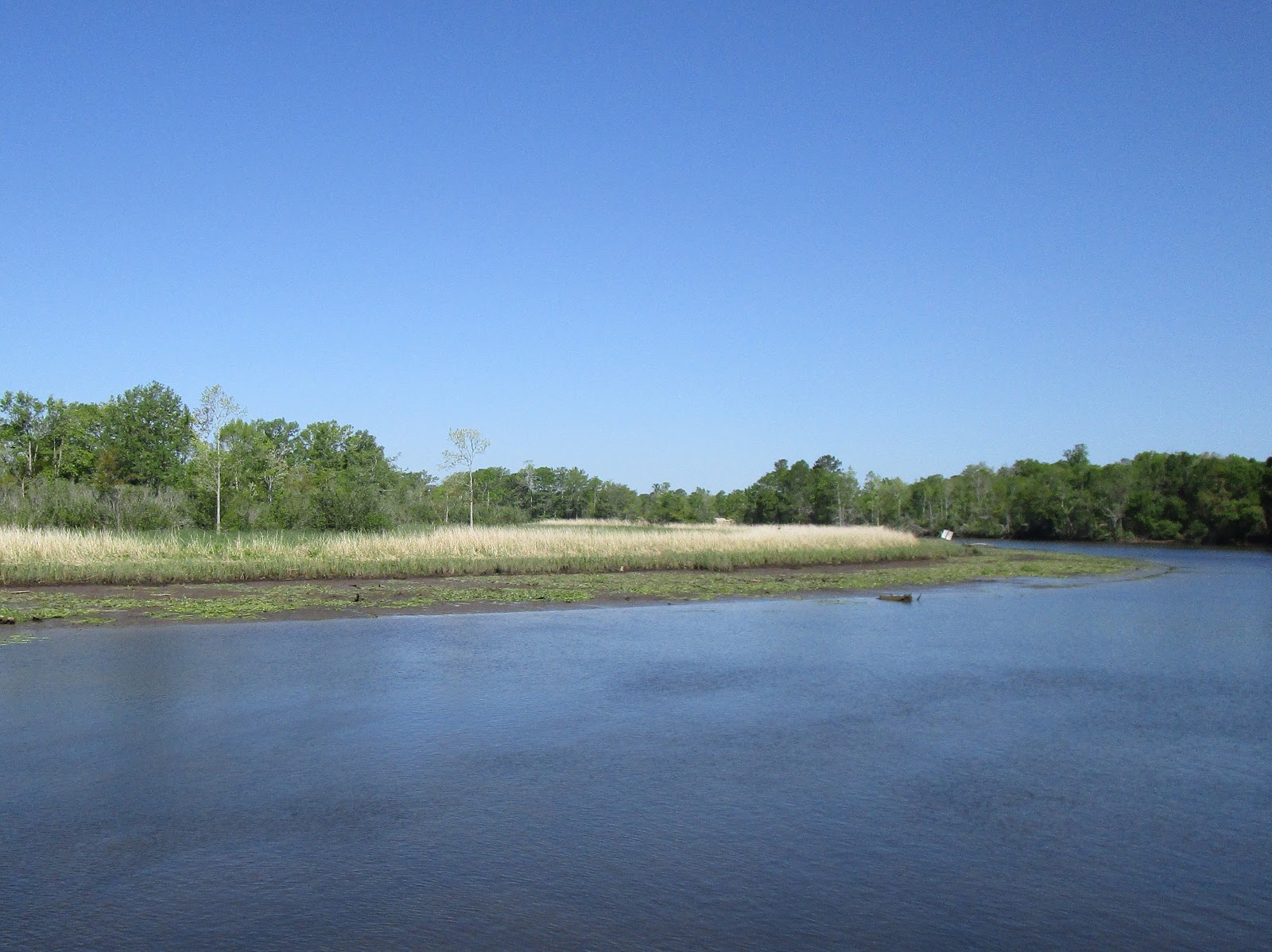
| Trees one side; nothing but marsh on the other |
With our
late morning start, we ended up negotiating some pretty shallow water come low
tide in the afternoon. Since Clark was busy, I piloted for a good length of
time. We arrived at a narrow section of water just before McClellanville. I
navigated around the crab pots that were clearly in the channel happy to find
upwards of 20’ of water under the keel of our boat.
Suddenly the
numbers dropped rapidly, and our depth finder started showing numbers less than
2’ depth. I quickly gave the helm to Clark since he seems to be a master at
finding deeper water or at least managing to keep us afloat in shallow waters.
As we wove around looking for deeper water, we got a call on our VHF radio from
a sailboat named Reva II.
We passed Reva, and their friend on the sailboat C’est La Vie, a short while earlier.
These two boats are from Canada. We could hear them conversing in French over
the VHF radio. They wanted to know if we found shoaling. Indeed we did! After we got through the
hair-raising bit of waterway, we could
see the side channel to McClellanville up ahead.
 |
| Fishing boat heading for McClellanville at the end of his day |
After we
passed the side channel to McClellanville, the water depths shot up to
comfortable levels once more. Phew!
As the
afternoon wore on, I hoped that we would arrive at our chosen anchorage soon. Clark
said we only had ten more miles to go after we passed McClellanville. I just
groaned!
We finally
arrived at Duck Creek where Clark chose to anchor just after 4:00. It took three tries for Clark to be
comfortable with the positioning of the boat. The first time he thought he was
too close to the port side of the river, then he decided he was too close to
the starboard side (I also did not like being so close to the weeds), and
finally he got it “just right”.
 |
| Sunset in Duck Creek Anchorage, South Carolina |
Friday 4/20/2018
Depart: Duck Creek Anchorage - 11:00
Arrive: Thoroughfare Creek Anchorage #1 -
2:00
Distance: 24 nm
Having dealt
with low tide yesterday afternoon, we decided to avoid struggling through South
Carolina marshland this morning and enjoyed sleeping in. Temperatures had
dropped by more than 20 degrees overnight, so we woke to cold temperatures in
the upper 40’s. It felt good to snuggle under the covers instead of facing the
cold.
As soon as
we exited Duck Creek to rejoin the ICW, at least 8 dolphins came rushing over
to check out our boat. I guess we did not pass some test they had for us
because they did not stay long playing by the boat. Two or three splashes
alongside and they left, so we had no time to grab a camera for a dolphin shot.
Having
become used to seeing miles of mud flats at low tide, I marveled at the scenery
approaching high tide.
 |
| Trees growing in the water |
 |
| Georgetown Paper Mill in background (glad we could not smell that at our anchorage!) |
 |
| Scenery on Thoroughfare Creek approaching anchorage |
 |
| Scenery on Thoroughfare Creek |
 |
| Anchorage site for the night |
The reviews
for this anchorage site said that the anchor holding presented a problem. In
some cases people moved to an alternate spot further along the creek to seek
better holding. Clark set his anchor alarm on his cell phone and then spent at
least a half hour verifying that we were not dragging our anchor.
 |
| Clark Working the anchor line to check for holding |
We wanted to
go visit the beach and trail area that we could see from the boat. Since we
planned to leave the boat, we had to be doubly sure that the anchor was set
properly.
Clark would
have preferred to use kayaks, but I convinced him to lower the dinghy for a
trip to shore. Since we approached the park at high tide, we found a rather
steep incline facing us. We managed to get the boat close enough that we could
jump out to have a look around.
Clark had
fun finding a place to tie the dinghy. Climbing up the sandy hill to a tree, he
managed to use his shoes as scoops and collect a large amount of sand in them.
 |
| Steep incline from water to park |
 |
| Clark positioning dinghy tied to a fallen-over tree on shore |
The effort
of dropping the dinghy and coming ashore was worth the effort. The wildlife
refuge was definitely a pleasant surprise.
 |
| Waccamaw National Wildlife Refuge |
 |
| Sandy Island Preserve |
 |
| Sandy Trail |
We really
did not know what to expect as we followed the trail through the very pretty trees.


The path
took us to a pretty view of a lake.


And a hiking
trail. We sat on the bench at the beginning of the trail to empty buckets of
sand from our shoes but decided we were not up for a 3-mile hike today.
 |
| Larry Paul Hiking Trail |
 |
| Bench courtesy of a Boy Scout Eagle Project |
Clark
suggested that, since we had the dinghy out, we should explore a bit further
down the creek. As we motored along, I suddenly signaled to Clark to slow down.
 |
| Turtles (lots of turtles) sunning themselves on trees |

 |
| Thoroughfare Creek Anchorage #2 |
 |
| Trees growing in the creek |
After
checking out the alternate anchorage site, Clark turned around and took us back
to Sunset Delight. As it turned out,
it was a good thing we were not gone too long. When we arrived back at the boat,
we found her aground. The tide had changed while we were gone. When the boat
tried to swing around, it came too close to the shallow side of the creek and
stopped.
Since the
back end of the boat sat among the lily pads, it did not look good. Clark quickly
climbed on board and came back to report that the depth finder showed 3.6’ of
water under the keel. “That’s funny”, I said, “because I can tell you this boat
is solid as a fixed dock! There is no movement whatsoever.”
Clark went
back to check the starboard side depth finder and came back with 0.5’ under the
keel. Fortunately, we were close to high tide. Had we returned later, we might
have had a worse situation. Clark used the anchor line, with me working the
helm, to get us off the muck and into deeper water. He shortened the anchor
line length to prevent us getting too close a second time.
With that
excitement over, we went back to pulling in the dinghy and stowing all the
equipment that goes along with taking it out for a ride. By the time we got
settled, it was after 5:00 and the weekenders came out to play.
 |
| 4 Jet Skis came to visit Sandy Island Preserve |
 |
| Seriously too cold for Bathing suits |
As the sun
set, the visitors to the preserve quickly packed up and took off leaving us
alone in the anchorage.
 |
| Sunset at Sandy Island Preserve |
Saturday 4/21/2018
Depart: Thoroughfare Creek Anchorage #1, SC
10:40
Arrive: Calabash River Anchorage, NC 5:25
Distance: 44 nm
We woke to
low tide so stayed snuggled in our cozy bed instead of rising to face the
chilly 50 degree weather. Our anchorage at Sandy Island Preserve certainly
looked prettier at high tide.
 |
| Muddy spot where Sunset Delight rested in the mud yesterday |
 |
| Sandy Island Beach has more landing space at low tide |
As we
motored along, the tide slowly crept in. What a big difference in scenery
between low and high-tide views.
 |
| View at low tide on ICW |
 |
| Zoomed in view |
 |
| Green Marker in Green-leaved backdrop |
We passed
nothing but green trees for a long way and then spotted a sign on the side of
the river.
 |
| Sign in remote-looking spot on the river |
 |
| Cut to Reserve Harbor Yacht Club |
Clark said
we were traveling in mostly fresh water along this stretch. That must explain
the cedar trees.
 |
| Cedar Trees “showing off their ankles” in the low water |
 |
| Typical scenery along the Waccamaw River |
 |
| Pyatts General Store |
We saw two
boats docked near Pyatts General Store. The tour boat must belong to someone
who is or knows French! For the other
one, I did not know that public schools owned boats.
 |
| “Tours De Sandy Island” and “South Carolina Public Schools” boats |
 |
| Wacca Wache Marina (love the name) |
 |
| Sailboat anchored across from the Wacca Wache Marina |
 |
| “Rabbit Ears” tree |
Clark wanted
to stay overnight at Buckport Marina where he saw an advertised low price of
$0.75 per foot of boat. He thought he called them and told they had no space
for a boat our size. When we passed by, they appeared to have plenty of space
at their dock. I noticed the fuel price
of $2..69 per gallon for diesel and mentioned it to Clark. He made an
about-face and pulled in for fuel.
We talked to
the dock hands while we pumped the fuel. They told us they had plenty of space
and would not have turned us away. “If you come by after hours”, they said,
“just tie up, and we’ll settle up in the morning!” They were above and beyond
friendly and I wished that we would not have gotten our signals crossed and
could have stayed there. I truly enjoyed chatting with the guys at the dock.
Clark thinks that he called a different marina and thought he had called this
one. What a shame!
After we
finished fueling (we took on over 200 gallons of fuel), I looked at my watch
and headed to the galley to make lunch. As I munched on my sandwich, I heard
Clark slow the engine and then blast his horn twice. I looked out the window
and could tell we were under a bridge and as far starboard as we could safely
go. Popping up top, I inquired as to the situation, and Clark told me that a
woman was driving the boat in front of him and started wandering in his path
oblivious to the fact that he was even there.
The woman’s
husband took control of the boat, pulled over towards port, and sped up to get
out of the way. We later watched that same boat weaving its way up the ICW in
front of us. “Sunday Drivers” out on a Saturday!
 |
| Wandering boat passing under bridge we needed to have opened for us |
I noticed
the blue color of a house and Clark grabbed the camera to take a picture. As we
passed by, I saw a sign that said “No Outlet” and a red “Stop Sign”. Getting
closer, I saw many more road signs along their bulkhead.
 |
| Now I know where missing road signs end up! |
Several
times now we have passed a dock with an unexpected sign on it. Today Clark
grabbed the camera to get a picture of that sign. I guess the owner likes
sarcasm.
 |
| Sign on Private Dock |
“Well,” she
said, “we have a problem. When we stopped traffic to open, a car hit the
bridge. Now we are waiting for the police to come. It will be a while before we
can open the bridge.” Later we heard her tell Hairless Joe and the other boater that an assessment would be
needed of the damage to the bridge. It sounded like it might take a while for
those other guys to pass through. Clark said, “I’m so glad that we did not need
to have that one opened for us.”
I have to
stop believing Clark when he gives me estimates on distance we will travel in a
day. I swear this morning when I asked he said we needed to go about 25 nm.
Over twenty nm into the trip I asked him “How much further?” He replied, “We
need to go about 20 nm more.” What!?
With 9 nm to
go, we passed a free dock where we stayed on the way south. We had no problems
when we stayed there other than worrying a bit about the depth at the dock. As
we passed by the dock, Clark read in the Active
Captain reviews that someone had stopped and tied up there. Later, they had
been told that overnight docking is not allowed and told to move on. Ho-hum, that means at least another hour of
travel.
Shortly
afterwards, Clark reviewed the route up ahead and realized that we would pass
through the infamous “Rock Pile” today. He did not realize that would happen
today. About 5 minutes before we got to the “Rock Pile”, he gave two Security
calls warning that we planned to navigate the narrow, rocky passage.
 |
| Rocks along the unforgiving sides of the “Rock Pile” channel |
Clark picked
the Calabash River for tonight’s anchorage. Not until I looked at the chart and
saw the home port for the local Calabash fishing boats did I realize that we
would be anchoring in North Carolina! With a 5’ tide change, we had to allow
plenty of line on the anchor to handle high tide during the night. With a lot
of line out, we had to worry about swinging into the mud (like we did
yesterday) on one side and swinging into the channel on the other. It took
three times to feel comfortable with our spot.
 |
| Clark working the anchor line |
As we sat
eating dinner, a big fishing boat came back from their day on the water.
He picked the worst possible time as far as our anchor situation was concerned.
At that precise moment, our boat was in the process of shifting position with
the changing tide direction, so it hung out into the channel. He passed very
close to our stern. Looking out the back window, I saw a crew member on the bow
talking to the passengers and giving the “what’s up with that” hand / shoulder
lift as he stared into our boat. Five minutes later we were safely tucked in parallel
to the channel out of harm’s way. Go figure!
I had hoped
to arrive earlier in the day at the anchorage and sit back to relax.
Unfortunately, given it took over a half hour to get anchored, I had to start
dinner as soon as we got settled. I guess I cannot lounge in bed in the morning
and have the afternoon to relax. It is one or the other.
After
dinner, Clark was on sunset duty and captured a good picture for tonight.
 |
| Sunset on Calabash River in North Carolina |
No comments:
Post a Comment