NM Today: 47
NM Total: 3052
Locks Total: 102
Since we navigated our last lock on the river yesterday, we had no worries about having to wait for / deal with locks today. Still we rose at 6:00 when the alarm sounded to start our way down the last segment of our river travels. The anchor was up and we were on our way shortly after 7:00.
The first item of interest on today's journey was the I-65 bridge. The guide book leaves it up to the reader to determine why it is referred to by the locals as the "Dolly Parton" bridge. It looks like an ordinary bridge from the water as it is approached head on. Apparently the view is somewhat different from land.
 |
| View of Dolly Parton Bridge (taken from the internet) |
 |
| Dolly Parton Bridge from the River View |
In addition to an interesting shape, the bridge has a red warning light atop each of the parallel support arches. Seems to locals have a vivid imagination.
As we traveled this last portion of the Tenn-Tom Waterway, we noticed a drastic difference in the vegetation along the river's edge. We went from deciduous trees changing their colors to cypress trees, marsh grass, and Spanish moss. I watched the shores carefully hoping to catch a glimpse of an alligator, but alas it was not meant to be. Instead we saw birds galore.
 |
| Change of vegetation on River's edge |
Me: "What are you taking a picture of now?"
C: "A flamingo"
Me: "A what?"
C: "Flamingo"
Me: "Where?"
C: "Right there"
Me: "That's an egret"
C: "No, over there in the water"
Me: "Oh, that's a pelican"
C: "Oh right"
Me: "I was looking for a pink bird with long legs!"
 |
| "Flamingo?" No, Pelican! |
As we came into the industrial waters of Mobile, I was like a kid in a candy store. I did not know which way to look to take it all in. Vessels of all sorts littered the waterway. The chart plotter shows the vessels with AIS position signaling which almost all commercial vessels use. The screen was plastered with the triangles used to indicate boat positions; they appeared to be stacked up on top of each other on the chart.
At mile 0.0 of the Tenn-Tom Waterway, we passed the Mobile Convention Center marking the official end of the Tenn-Tom.
 |
| Mobile Skyline |
 |
| African Sunbird from Panama |
 |
| Looper Boat Mosey III beside African Sunbird |
 |
| Tall Ship |
 |
| Military Vessels |
 |
| James Bond-type Stealth Vessel? |
 |
| Even Ships in Drydock for Repair |
Although there are working ports in New Jersey, we do not tend to boat there, so the busyness of the bay was definitely something to behold. Clark was busy navigating through the area with one eye on the traffic and the other on the camera.
 |
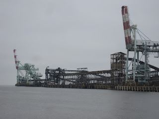
| Ship Loading Site |
 |
| Cranes for Loading Containers onto Container Ships |
 |
| Containers Galore! |
 |
| Another Boat-Loading Work Site |
As we pulled into the marina, we saw several other looper boats that we recognized from our travels. After checking in we walked over to the Dog River Marina right next door and found many more of our looper friends staying there. We met looper folks we had not met previously on a vessel named Allez! , and we reconnected with folks we have not seen since the Joe Wheeler AGLCA Rendezvous.
After socializing for quite some time at Dog River Marina, we returned to Sea Moss for a quick dinner of leftovers from the night before. I decided to take advantage of the washers and dryers and threw a load in to get that out of the way. While sitting at the picnic table area by the washer/dryer (which happen to be outdoors under cover) and waiting for the dryer to finish, I had time for more socializing with loopers staying in Turner Marine where we are docked.
 |
| Sunset at Turner Marine in Mobile, Alabama |
 |
| Turner Marine in Mobile, Alabama at night |
No comments:
Post a Comment