17 May
2020
Depart: Free
dock east of Great Bridge, VA 8:55
Arrive: Mill
Creek / Wicomico River, VA 6:30
Distance:
76 nm
We slept too
late to get the 8:00 bridge opening, so we targeted the 9:00 and ate a leisurely
breakfast, etc. At 8:55 we pulled away from the dock ready for the bridge and
then the associated lock. We transited the bridge with no difficulty, but we
cannot say the same for the lock.
 |
| Great Bridge Lock |
Given we tied up at the free dock, we had lines and fenders on the starboard side. Unfortunately, due to Covid-19, the Army Corps of Engineers mandated that all boats lock through on the port side (away from the lockmaster’s station). I moved the lines and started to move fenders until the lockmaster said the wall of the lock was rubber. Then I decided I better leave the fenders off so they wouldn’t get stuck in the large slots on the rubber wall.
Normally when we pull into a lock, I set up a bow line, and Clark grabs a stern line. That plan went sideways in a hurry today. I got the bow line attached. Clark said he would “back on it” to bring the stern around. Try as he might he could not bring the stern over even using engine power and the stern thruster. After 3 or 4 attempts I told him to stop. I was very worried that either the line or the cleat would break. At one point the line caught on the anchor. It was a bad situation.
Finally, I got Clark to agree that I should pull off the bow line to allow him to realign the boat parallel to the wall instead of perpendicular to it. Thank goodness it is a wide lock, and we were the only boat trying to lock through.
The lockmaster stood at the side watching the show. After I pulled off the bow line, he said that we needed to get a mid-ship line first. I asked Clark if he agreed to that, and the answer was, “No, get a stern line.” That worked. I got the stern line. Clark got the bow. Then we traded places since I found it difficult to reach to work lines from the stern.
When we do locks on the Erie Canal, the water lift or drop is measured in terms of feet – usually many feet. After all the stress of fighting with getting lines set up for this lock through, we only went up by at most 6 inches. For that, we could have just sat in the lock without lines and been just fine. What a fiasco! When it was all done and we could relax, Clark explained that he had not counted on a strong current in the lock itself.
We exited
the lock at 9:25. It took me another 20 minutes to stow all the lines, fenders,
and fender boards to put everything in shipshape condition. Even in shorts and
t-shirt, by the time I was done, I was wringing wet with sweat. When I came
back in the boat, I found Clark piloting the boat wearing long pants and a
jacket. As the day progressed, my attire became more like Clark’s and then
surpassed him in layers. It was hard to believe I started the day in shorts and
ended it in a fleece and coat!
For once in
our lives, as we approached Norfolk, the Norfolk Southern #7 bridge was open, and we had
no wait. That never happens. Usually we have to float around with a long wait
to pass.
 |
| Railroad Lift Bridge entering Norfolk area |
 |
| Bridge Tender is way up here |
Having been
through Norfolk a number of times now, many of the sights remain the same. We
did notice some differences. For one, we passed by a plant that generated a
smell that reminded me of buttered popcorn. It was delicious! I figured anyone
who lived in the area either constantly craves popcorn or is repulsed by the
thought of it.
 |
| Popcorn factory?? Doubtful but it sure smells good here. |
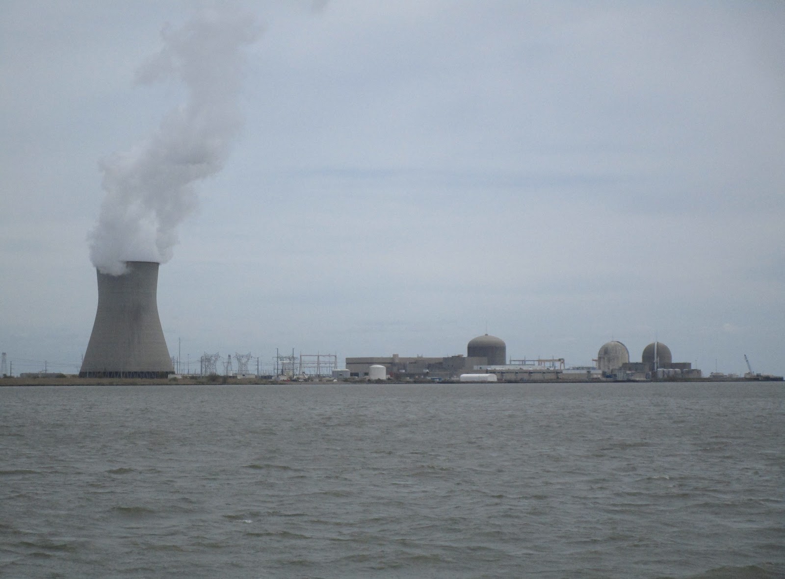
Of course,
we saw lots of naval vessels.
 |
Check out the trellis work on this one.
How many flights up to the top? |
We caught
sight of a few NOAA vessels.
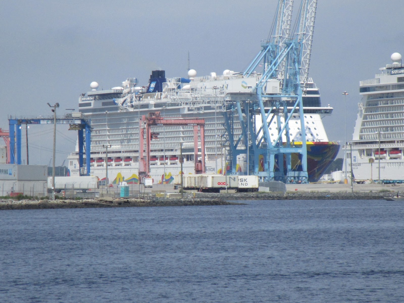
As we continued
on, we saw a cruise ship in the distance. As we progressed, we saw another, and
then, another. All three were part of the Norwegian Cruise Line.
 |
| Norwegian Spirit |
 |
| Norwegian Bliss |
 |
| Norwegian Encore |
We passed by
the Waterside and Tidewater Marinas.
 |
| Waterside in Norfolk, VA |
 |
| Tidewater Yacht Marina |
We saw a
pair of cute, little tugs.
And a couple
of more traditional-sized tugs.
As well as some other miscellaneous items of interest.
 |
| Ferry |
 |
| Cranes Galore |
 |
| Boat / Crane |
 |
| Coast Guard Boat |
Having seen
all the sights Norfolk had to offer, I decided to go below to do the dishes I
saved from last night. After I got that job done, I made lunch. Clark said I
picked the absolute worse time to go work in the galley. As we came out of the
Elizabeth River and crossed the Hampton Rhodes Inlet, we had wind against current with the wind driving waves in from the ocean to the east as the tide was running out. As Clark said, “The swells made it
exciting!” Meanwhile, I was bouncing around in the galley chasing food across
the counter tops and thinking that the whole trip on the Chesapeake Bay would
yield the same results.
While I was
in the galley, the alarm sounded for the alternators. Sometimes when I run
electrical appliances in the galley, it goes off. Not today, not me! I was not
using any electricity to make my sandwiches. I made my way to get a view of the
upper helm and found Clark trying to adjust the lift arm for the dinghy. It too
was bouncing around and banging into the railing. Every time Clark tried to
operate the lift to move it, the alternator / battery alarm sounded. So it was
him today not me!!
I climbed up
to the upper helm thinking, “Who’s driving the boat?” As soon as I got seated,
however, Clark came and took over again, so I went back down below to finish
making lunch.
I brought Clark
his lunch to eat up top, and I stayed below to eat as per usual. After I
finished eating, I went up top. Clark told me he wanted to investigate the
alarm. He told me to get the headsets so I could read the battery voltage numbers
before and during his work on the lift. With that, he tried to work his lift
again, and this time he was successful in moving it. He thinks now he should
make an adjustment to the sensitivity of the alarm so it does not go off so
easily.
After I ate
lunch, I came back up top and was amazed at the lack of a view. All I could see
was fog! The shoreline was barely visible in the distance. Clark had the radar
going, which is quite unusual. We have had such perfect weather and calm seas
that today was a big change.
 |
| Foggy today - reduced visibility |
Although we
rocked up and down, the waves did not seem that big, but once in a while, unexpectedly,
we could get a spectacular splash as a wave collided with the bow of the boat.
 |
| Spray! |
The further
north we traveled the calmer the seas. By the end of our travels the waters
were quite flat.
During our
time on the Bay, we did see some interesting sights.
 |
| Wolfe Trap Light |
 |
| a not-so-green green buoy |
 |
| Here's the reason |
 |
| A greener “Green” buoy |
Since it
looked like we would yet again be getting into an anchorage too late for the
evening news, Clark disappeared for a while and figured out that the reason we
could not get the TV display on the chart plotter was due to a lose wire. After
he fixed that, he grabbed the chart plotter instruction manual to look up how
to split the screen. He made a custom screen display that allows us to look at
the route in one window and watch television in the other. As ridiculous as it
sounds, we can now watch TV while cruising. At 6 o’clock, he put the news on
and sent the display to the upper helm display unit.
Since I was
diligently looking for crab pots, I couldn’t watch it, but I could listen to
the news.
We found a
nice spot where we could drop anchor with plenty of swing room as well as
depth. Since we got in at 6:30, I left Clark to do clean up work while I went
to cook the dinner that was meant for last night.
I spent the
whole night working on blog updates while the movie “Mission Impossible” played
on the television nearby. The internet signal was so weak that it took ages to
upload each picture for the blog.
18 May 2020
Depart: Mill Creek / Wicomico River, VA 7:45
Arrive: Harness Creek off South River near Annapolis, MD 5:15
Distance: 77.5 nm
Due to tropical storm Arthur, we expected to see rain today. We hoped to have some clear weather to start the day. However, when we got up to get going, drizzle greeted us to start our trip. As soon as we could we got underway. Breakfast could wait.
We started piloting from the upper helm, but very quickly we decided to adjourn to the pilot house. Up top, we either got wet or had near-zero visibility through the front panel. At least down below we had windshield wipers to increase our viewing distance. Knowing we saw traps when we entered Mill Creek yesterday, we both watched intently to spy them as we exited to the main channel on the Chesapeake Bay.
Our ability to take pictures was severely hindered by the conditions. We had bow-on waves making us rock up and down constantly. This caused spectacular splashes over the bow of the boat.
Depending on where we were on the bay, the waves picked up or settled down some. Crossing the end of the Potomac River is always interesting. Today it proved to be one of the rough sections of the trip.
 |
| Point No Point Light |
At 12:30, when we arrived at marker 1PR for the Patuxent River, we had a decision to be made -- stay the night at an anchorage near the Solomons or continue on for another 4 to 5 hours. I couldn't see Clark sitting idly by in an anchorage for the rest of the day, and I did not care one way or the other. I left the decision up to him. As expected, he opted to continue on. He said that he found a protected anchorage that we have not visited in the past, so we headed there for tonight.
 |
| Cove Point Light - Lit Lighthouse |
 |
| Cove Point LNG Terminal |
Clark saw a couple of things he thought were traps that turned out to be something else. The first one turned out to be a floating, empty plastic container. The second turned out to be a floating hunk of tree limb.
 |
| Floating tree limb |
I missed a good portion of the afternoon ride as I laid down on the sofa in the pilot house to get comfortable. Clark had NPR on the radio again, so I listened to that for a while but eventually drifted off to sleep.
Even though I was lying right there behind him, Clark said he could not find me. When he looked at the sofa, all he saw was some pillows and my coat. He said he looked all over trying to find me and even considered turning the boat around to scout for me out there floating in the bay. When he came back to the helm, he spotted a pair of legs hanging off the side of the sofa and breathed a sigh of relief.
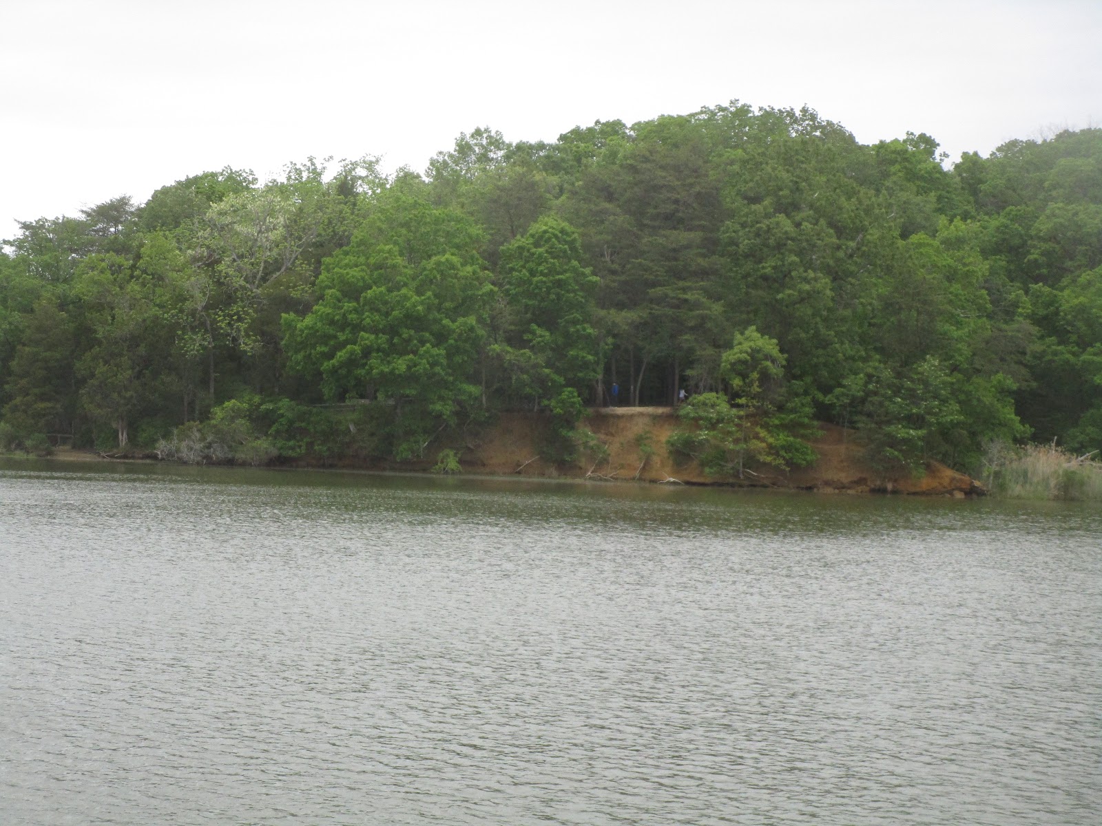
As predicted we arrived at the South River around 4:30 and headed in to find Harness Creek and our anchorage for the night. Per usual, Clark picked well. The further in we traveled the calmer the water until it was flat as could be. The spot where we dropped anchor is well-protected as promised.
 |
| Entrance to Harness Creek |
Scenes along the Harness Creek
 |
| Kayaks on the creekside |
 |
| Sailboats Anchored in Harness Creek |
After anchoring, a small boat came by with a man and his dog in it. As he swung by, Clark popped out to say hello and snap a picture.
We had too much cloud cover for a sunset picture tonight!